

Somewear Labs
Official trusted suppliers
Somewear offers a satellite-enabled platform for those who venture or operate beyond the limits of cellular connectivity. With the best-in-class, lightweight satellite solution and user-centric software, Somewear keeps people in touch, informed and safe anywhere in the world.
J6 Solutions are pleased to offer the very latest products from Somewear Labs, both in terms of hardware and software. Bolster your communications plan with robust, beyond line of sight capabilitites.
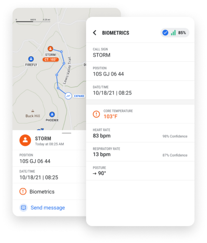
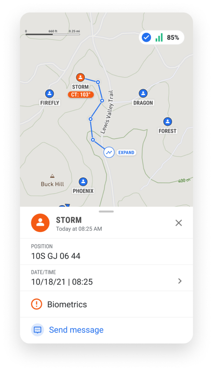
Either operating TAK, or leveraging Somewear’s bespoke software, Grid Web & Grid Mobile, have complete command and control over your most valuable assets. Give you and your team complete piece of mind.
Somewear Labs Products


Node
MESH + SATELLITE CONNECTIVITY
An encrypted multi-network solution, combining the efficiency of mesh radios and the resilience of satellite technology with SmartBackhaul™ technology.
Global Hotspot

COMMUNICATE. TRACK. PROTECT.
An encrypted, resilient satellite solution that integrates into any kit. Ideal for asset tracking and for isolated personnel who require SATCOM to stay connected.
Key Features

ATAK
Through Somewear’s first-of-its-kind ATAK (Android Team Awareness Kit) integration, operators can utilise the native features of ATAK through low-bandwidth satellite connectivity maintaining situational awareness in the most austere environment.

Smart routing
The technology is designed to utilise the path of least resistance to transmit/receive data, leveraging Wi-Fi and LTE when available and automatically connecting to the Iridium network when LTE coverage is unavailable.
Sensor integration
In addition to communication and location data, Somewear has built a system capable of a wide range of integrations. From body-worn sensors to remote unattended sensors, Somewear integration can help provide real time insights even for sensors found in austere environments.
SOS
At its core, Somewear provides a critical line to safety in the event of an emergency. With Somewear’s federal solution, leadership can choose to re-route SOS alerts to the proper tactical response team. This ensures that an operator’s SOS alert is immediately pushed to the team that can provide a quick and discrete recovery.
Reliable and effective off-grid communication
“Seemless integration with ATAK, easy to connect and control via the main TAK interface”
“Astonishing results achieved between two individual nodes. Gamechanger”
“Reliable, user friendly, I feel so much safer when off grid”


Somewear product FAQ’s

-
Anybody can! Utilised in various industries around the world. The equipment can be used for lone adventurers or fleet operations. Get in touch via our contact link and find out more.
-
Depending on your requirement and how much satellite data you'll be leveraging, will determine the data package fit for you. Get in touch and one of our experts will provide a free consulatation to advise the best package for you or your teams.
-
Get in touch with us at admin@j6solutions.co.uk. You'll receive a free consultation on how we can optimise your communications, and advise on the hardware and package that's right for you.
-
Both products utilise the LoRA frequency band, operating at 902-908MHz, as well as the Iridium Satellite Constellation for beyond LOS communications. It's operable with your mobile device and can also leverage your 4/5G device connectivity. All products are rated at IP68.
-
With a purpose built TAK integration, the devices seamlessly integrate into your main TAK user interface. Devices do not require being paired to a mobile device, meaning as a team leader, you can have complete command and control of your team's safety with all PLI information reporting into your very own TAK server when completely off grid.